On the 29th of last month I journeyed to Maze Hill railway station, walked north towards the river, just as I had planned, and in due course got to this spot:
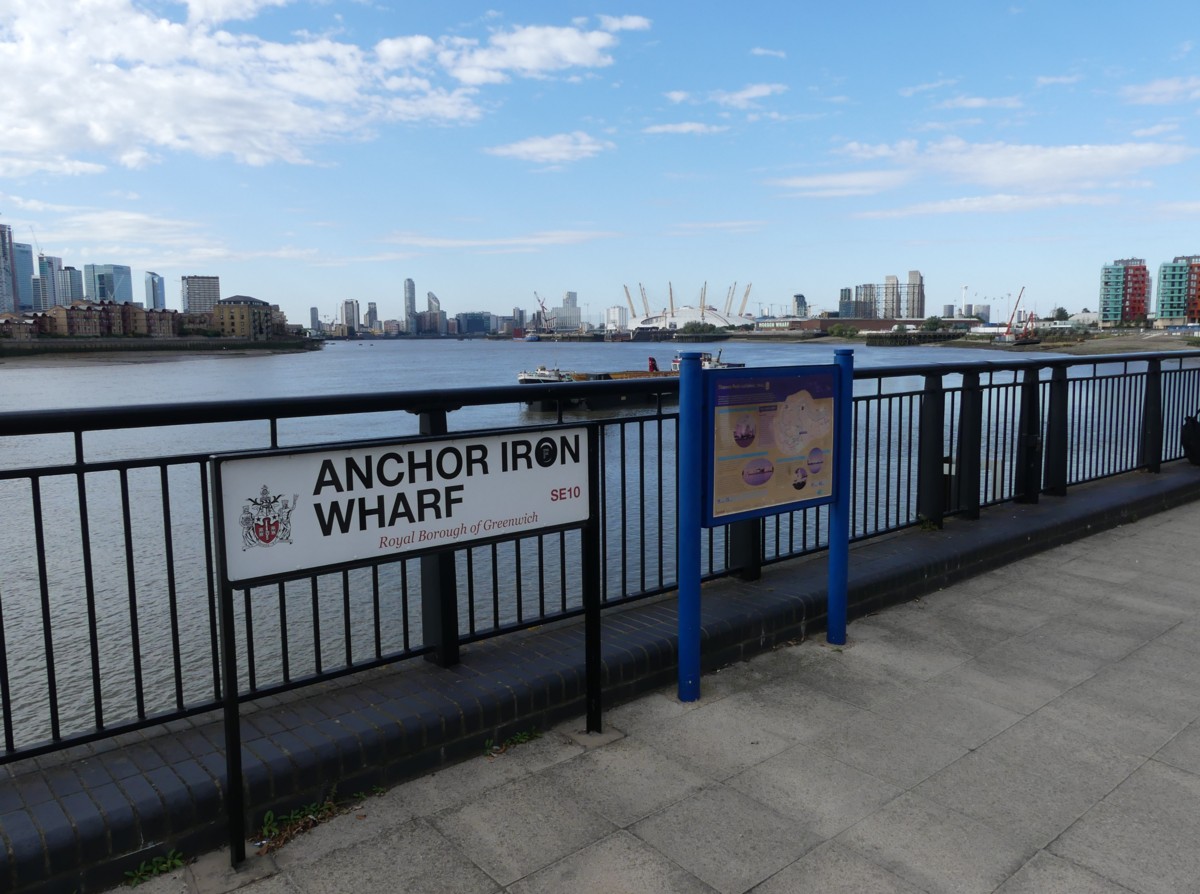
I’m looking at signs. And I’m looking past the signs in the direction I intend to go. I love these signs that London has everywhere. And presumably also every great city in the rich world.
Let’s take a close look at the sign on the right in the above photo:
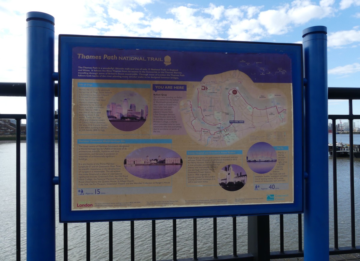
As you can perhaps see, this sign contains chunks of written information about places nearby. Chunks of the sort that I do not like to spend time reading direct from their signs, but which I do like to photo and then read later. Chunks like this:
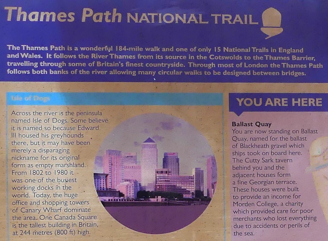
So, the Isle of Dogs got its name from Henry III’s dogs, did it? Well, maybe. This is a fun maybe-fact, I think. Henry III was the one who had to escape the clutches of, and then execute, Roger Mortimer, Mortimer being the one who toppled Henry III’s Dad, Henry II. Henry II did badly. Henry III, at any rate by the standards that his subjects cared about, did very well, at least at first. What this means is that Henry II fought against his own nobles, in England. Henry III fought against the French, in France. Given how much pillaging and plundering and sheer destruction was involved in medieval warfare, in order to deny supplies to the enemy, Henry III’s wars were greatly preferred by the English.
(MUCH LATER: The above paragraph is mostly bollocks. Henry III was indeed the one with the dogs. But, I was muddling Henry III and Henry II with Edward III and Edward II. It was Edward III who fought against the French and whose Dad Edward II was deposed by Mortimer. Sorry. Now, back to the original posting, which still makes some sense, even though it is nothing to do with what it says on the sign:)
I know what you’re thinking. Why not just not have any wars, anywhere? Ridiculous. What century are you living in? This one? There you go. No wonder you just don’t get it.
However the sign is now out of date on the subject of the tallest tower in Britain. That was indeed, once upon a time, One Canada Square. But the Shard has since, metaphorically speaking, toppled it. See here for details of that story. The soon-to-be-completed 22 Bishopsgate is already also a lot taller than One Canada Square.
However, I am puzzled about whether we are at Anchor Iron Wharf, as claimed by the sign on the left in the first photo in this posting, or on Ballast Quay. Many the former ends on the left with sign on the left, and the latter begins on the right with the sign on the right.
The right sign also contains a map, which is rather faded (what with it being a rather ancient sign), but this had the effect of throwing my intended journey into sharper relief:
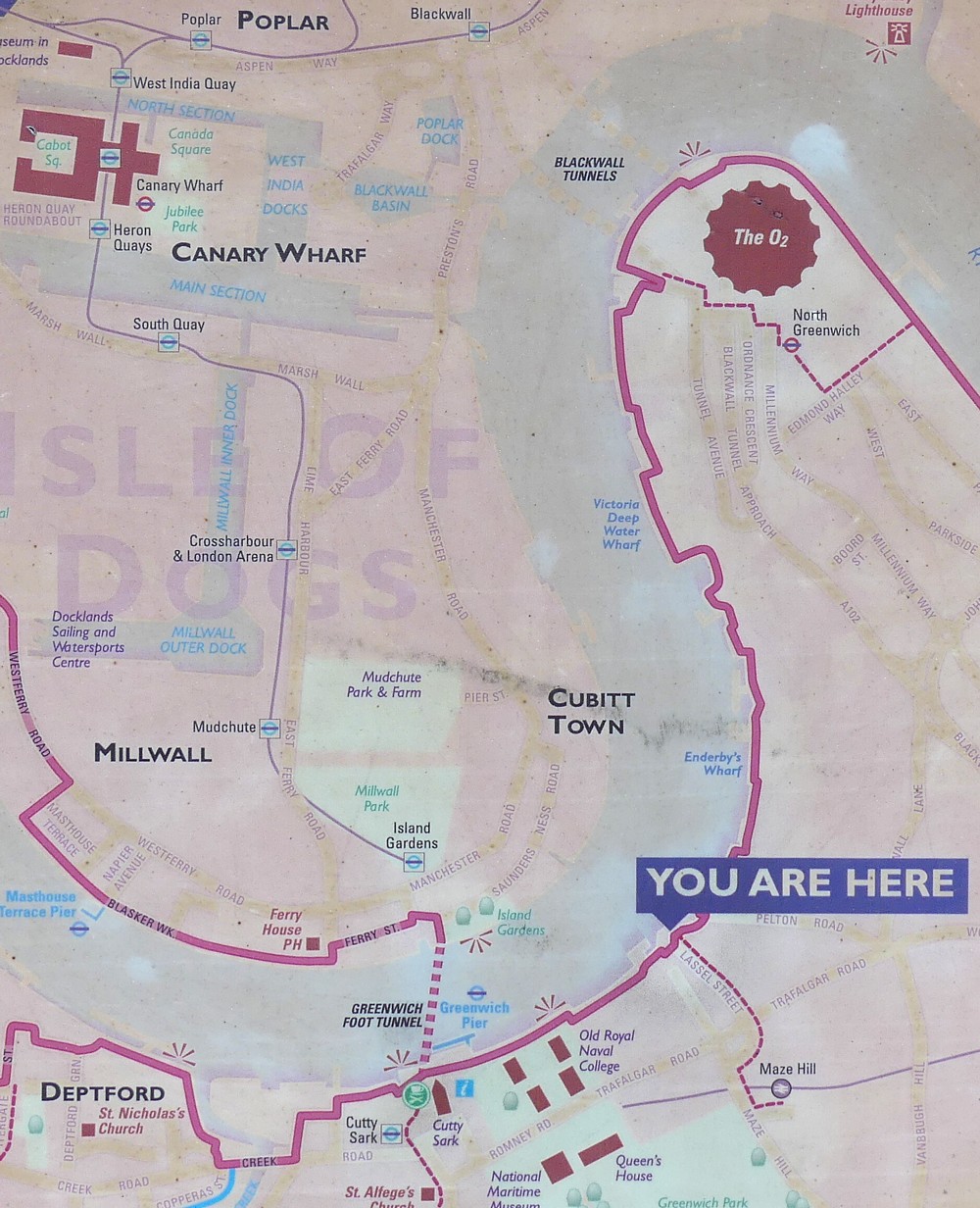
This map even helpfully shows, with a thin dotted pink line, the very first part of my walk from Maze Hill station to the River. Having thus arrived at where it says YOU ARE HERE, my plan was to follow the thicker squiggly pink line north, beside the River, all the way around the north of the Dome, and then either go across the River on the Dangleway, or else just go home on the tube from North Greenwich.
And that’s what I did.